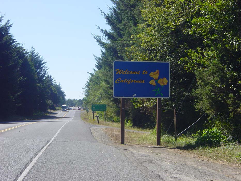
Last night, I ordered a pizza from a local place (as I often do) and it was freaking huge. I knew it was going to be a deep dish Sicilian style, but not that it would be 14" (I thought it was 12"). While watching football I managed to eat the whole thing (keep in mind I hadn't eaten since just after noon, and had gone through all that terrible hill climbing, so I was really, really hungry). Well, that was one piece of pizza too many, so the rest of the evening I sat around feeling overstuffed and barely able to move. Plus, I couldn't get to sleep, and so didn't get up until about 10:30, making me race the clock to beat check-out time. So it wasn't until about 11:15 that I left Brookings and turned south, enjoying a nice tailwind of about 20mph that went on pretty much all day. About seven miles later I encountered this sign, which pretty much speaks for itself:
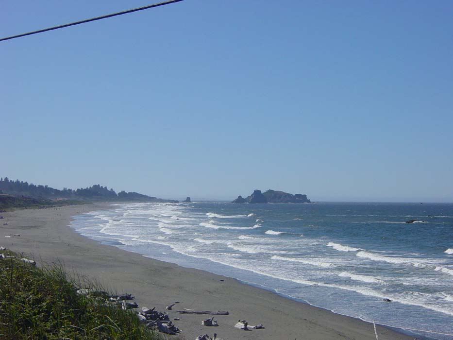
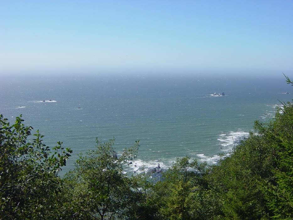
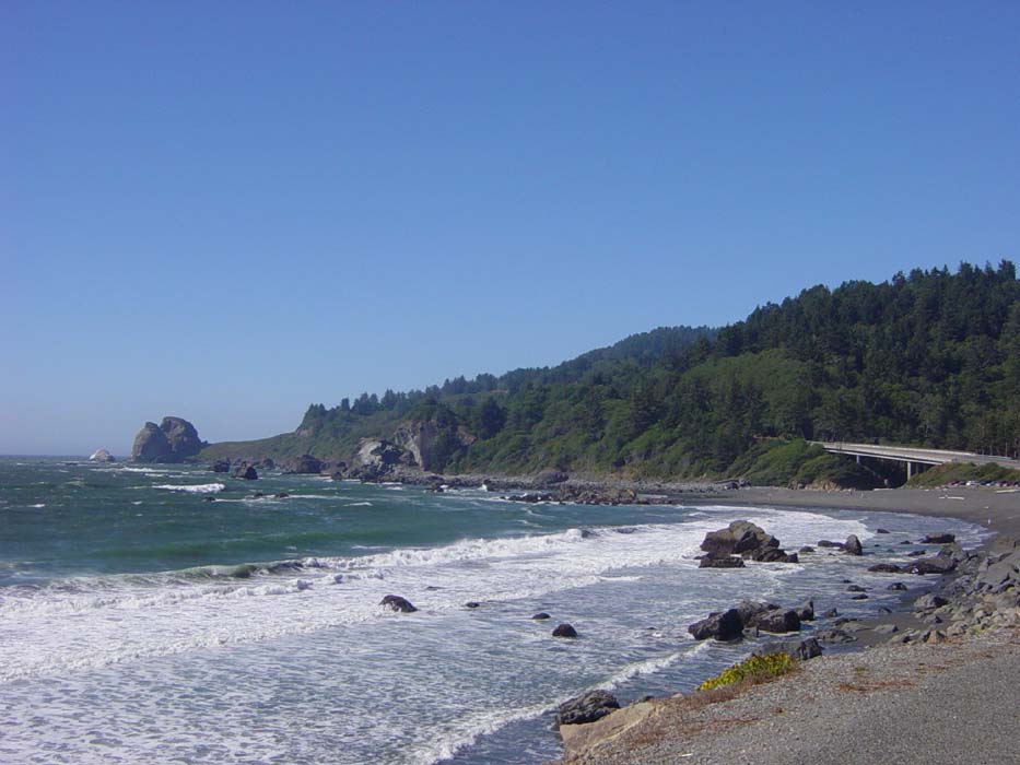
The next sign there tells me Crescent City is 19 more miles away, which is where I was planning to have lunch. The road all the way to town was relatively flat and so I cruised along for the next hour and a half or so, enjoying an easy ride, which was very welcome after yesterday's hill-climbing marathon. Here's what the beaches looked like along here:
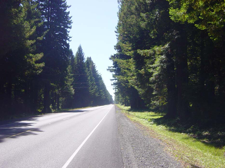
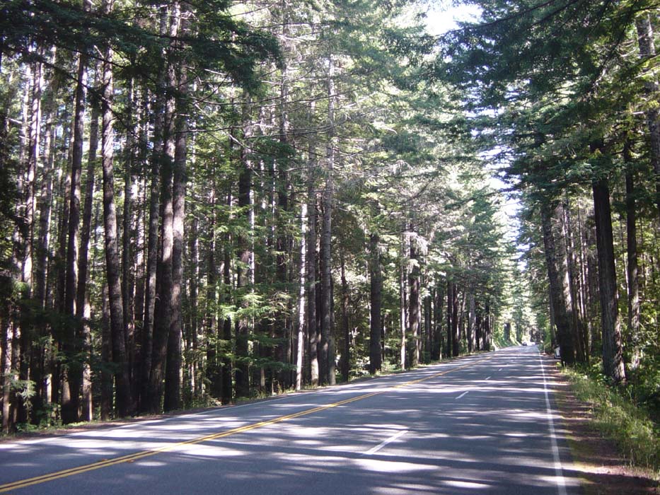
And here's what the inland part of the ride looked like. The trees did block the wind, unfortunately, but the road was still pretty flat and basically enjoyable all the way to Crescent City.
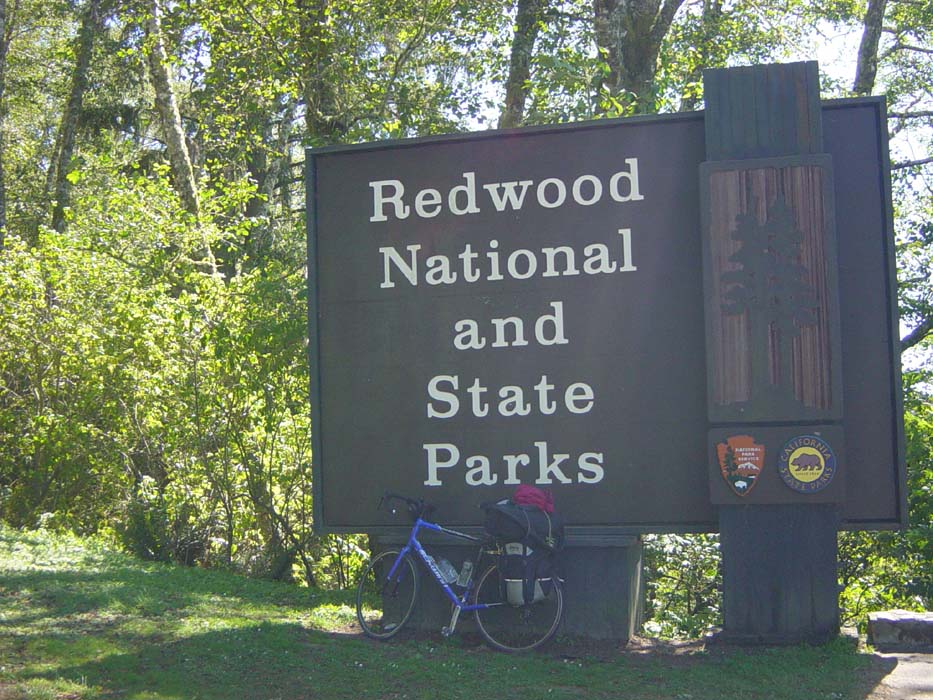
After grabbing some lunch at Burger King, I headed over to the visitor's center (seeing as I was in a new state, time to pick up some new maps) and chatted with a park ranger about some of what was coming up on my ride later. He pointed out several potential campsites, as well as mentioning that I should take a scenic byway that breaks off from Route 101 and heads through a redwood forest. Plus, as a bonus, there was a large campsite at the end where I could stay. The timing seemed right (that would be about 55-60 miles for the day) so I figured I'd try for that.
With some new maps in my pocket and what I thought was a pretty good plan, I made my way out of town and got my first look at the terrain I'd soon be facing:
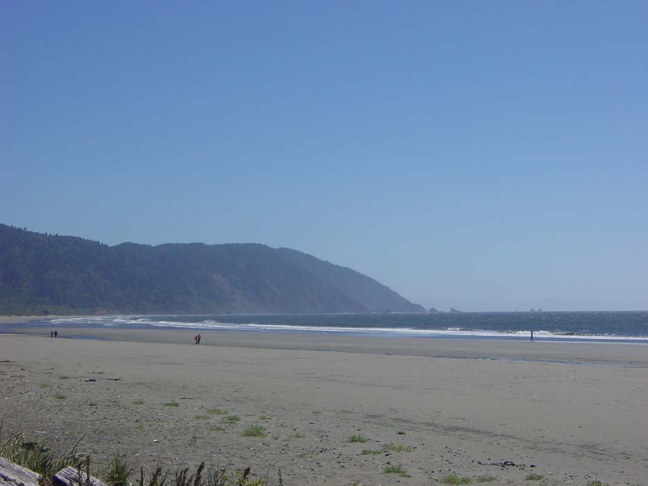
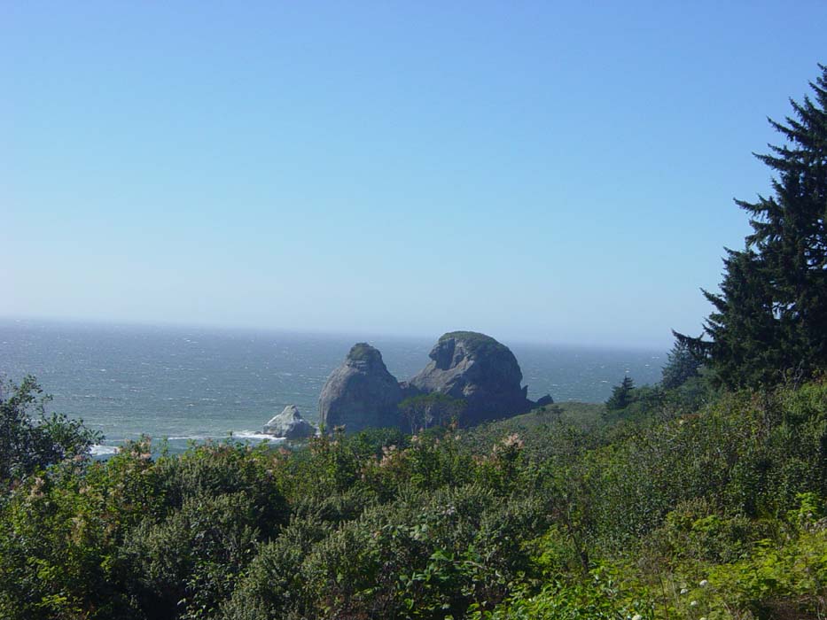
Yep, that's right, more hills! Well, at least I had over 25 miles of easy riding to get ready for it, unlike yesterday. The first hill started fairly easily and then grew steep fast, so that after a mile or so I was already getting tired. There was a scenic overlook that gave me a good first rest stop, so I snapped this shot of Crescent City in the distance.
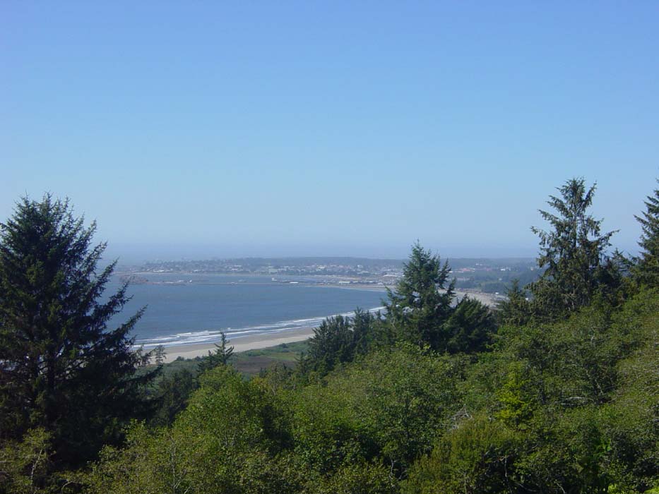
As it turns out, I was actually riding into something you've all probably heard of, namely this:
Notice I have my jacket strapped to the back of the bike today. This is because drivers entering this forest have to turn their lights on, owing to how shady it gets along the road. Since I was wearing dark stuff, I threw the jacket on there for better visibility. Not that it matters, really, as it's quite easy to spot a bicyclist pretty much any time, unless it's completely dark and they have no lights on.
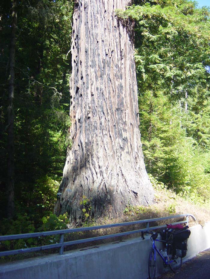
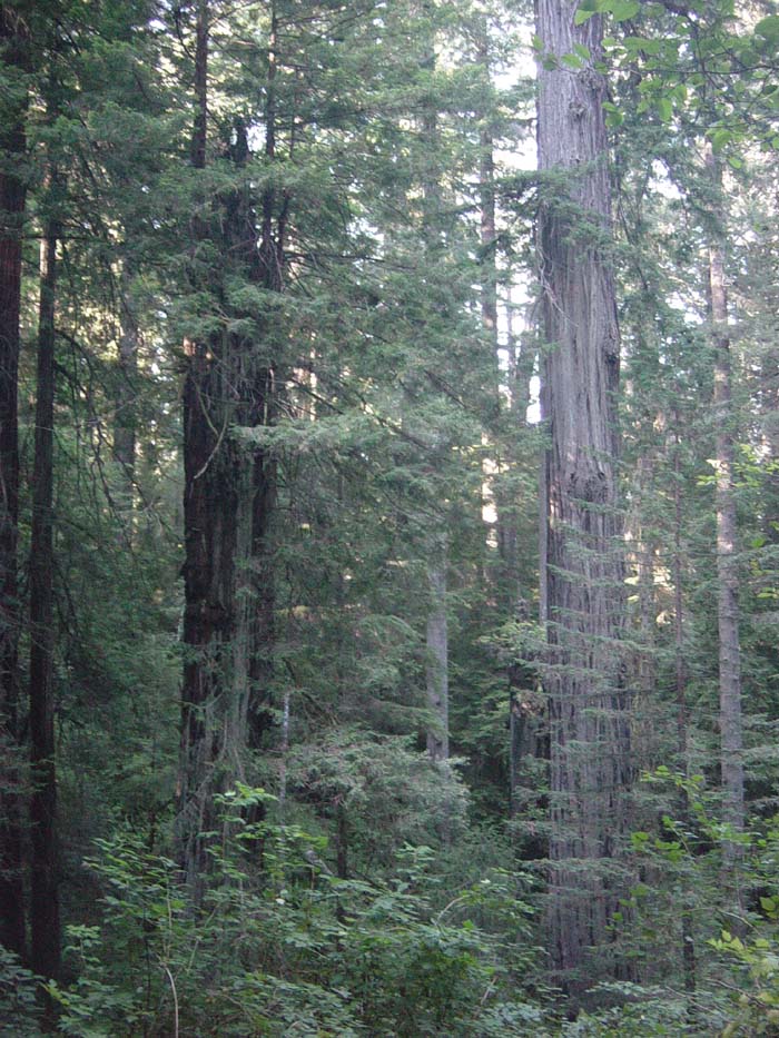
Anyway, the road continued on up into the redwood forest. About another mile and a half up, I finally got too tired to pedal further and there seemed to be no end of the hill in sight, so I stopped for a couple of photos. Many of the trees are normal pines, but you can tell the redwoods by their sheer size. They also have mostly gray bark, which gets a reddish tinge during growing season, hence the name.
Here's another picture of a redwood by the road near my bike, so you can get a better idea of the size we're talking about here. These are coastal redwoods, by the way, not giant sequoias, which are much rarer and only grow way inland.
So after recovering at this rest stop I headed on for another mile or so and was STILL climbing...so yet another stop, where I finished the last of the water in my 32oz bottle, and started on the 24oz backup one. (I also have another 24oz backup for the backup, stuffed underneath the duffel bag, which I've had to use twice now.) This was a section where the forest was especially thick:
Notice the passing lane (every curve, I would hope to see the "lane ends merge left" sign) and lack of shoulder. The passing lane made it no real problem having no shoulder, as traffic was light on this Sunday afternoon, so everybody just cruised past me on the left side. The climb finally topped out at just over 5 miles, by far the longest climb of the trip so far. Plus, as an added bonus, I got another two more mile-long similar climbs a bit further up the road, putting me God knows how high up but it must've been well over 1,500ft and maybe more like 2,000.
When the descent finally started it was right along the coast, giving me some pretty amazing views that I had to glance at while tightly clutching my brakes, dodging torn-up sections of road and making sure I didn't get too close to the edge of the mostly nonexistent shoulder. Here's a pic from one of the few spots I could find to safely stop:
Here's another one, taken maybe halfway down:
This one was taken at the only marked overlook on the descent (the others were snatched during gaps in traffic). By this point I'm getting fairly close to sea level again, but it's still a pretty nice view.
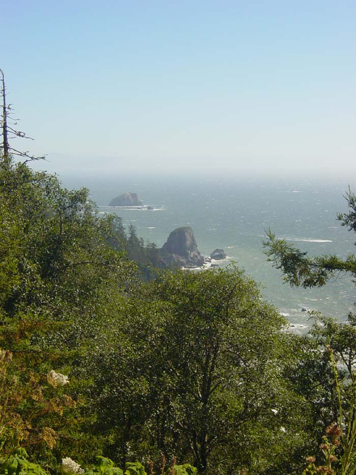
To the right of this was an oddly-shaped rock formation:
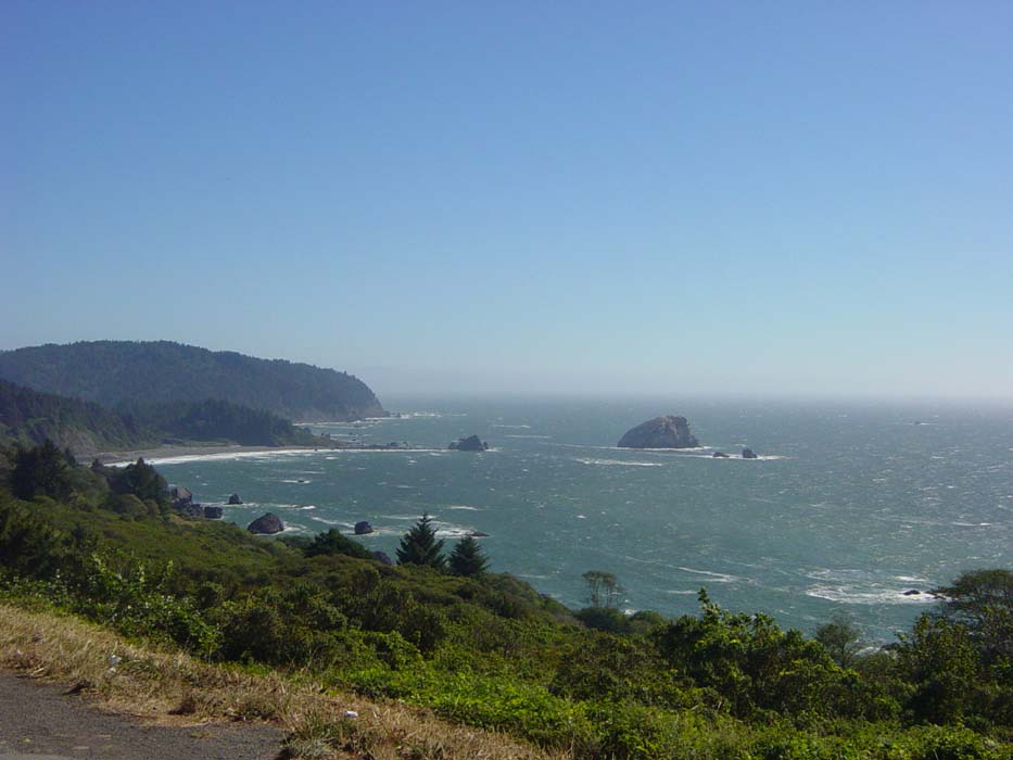
Finishing the descent, I turned back for another look at the coast I'd just passed. That rock on the left is the same one from the previous pic. You can get an idea of the steepness of the hill (about 6% grade) from the road there, which twists on up the side of the hill above that bluff.
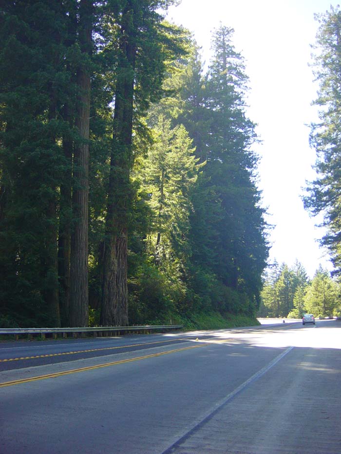
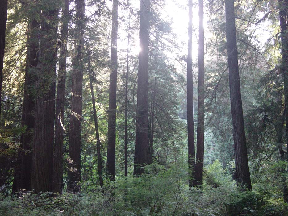
I only got to enjoy the beach (and that tailwind) for about 15 minutes before starting to head inland, towards the town of Klamath, which sprawls out alongside a river and has a population of about 800. Even so, it had one hotel (full), a Subway (where I refilled my water bottles) and several RV parks and campsites. It was only 4:15, I was feeling pretty good, and there were more campsites ahead, so I decided not to stop. This led me to another big climb that went on for about 2 miles, followed by maybe a mile of even terrain before the entrance to the Redwood National Forest scenic road the park ranger told me about. Remember he also said it was pretty flat in there? Yeah, well, he forgot to mention the 2.5 mile climb leading into the park. Once I dragged myself up over that, yeah, it was pretty flat, but I was mocking him under my breath the whole way up. He was right about the ride, though. It was amazing. Nothing but redwoods all around, crowding the road, sometimes actually growing right on the shoulder (forcing me to dodge them). This picture here is typical of what I could see every time I turned my head:
Here's another one, with the light coming through the trees. The sun was actually starting to get fairly low at this point, as it took a while to climb those last couple of hills, and I wasn't exactly hurrying through this forest.
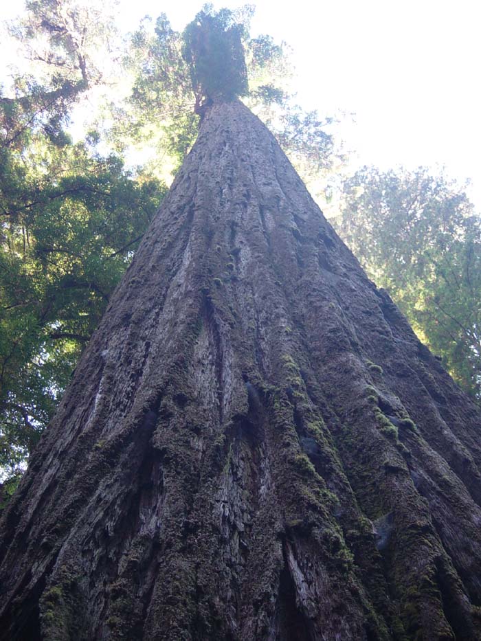
These pictures really don't give you any indication of the scale of what I was looking at. These trees are amazingly tall. I stepped up next to one and took this shot looking up. Notice how at the base the tree completely fills the camera view.
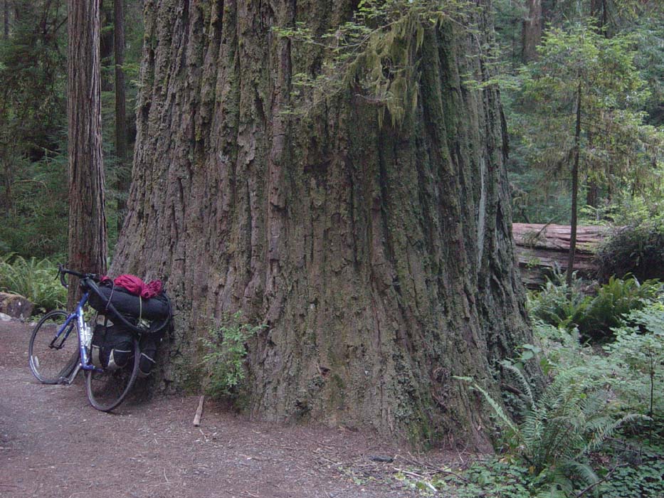
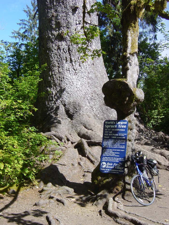
And now just in case you still don't get it, here's the same tree in comparison to my bike. If you go back and look at the one I featured next to the bike earlier in the day, you can see that was just a little guy compared to this. Oh, and that "World's Largest Spruce Tree" way back on Day 9? There were trees bigger than that everywhere I looked in this place. (Here's a link to that picture if you don't want to have to go back and find it again.)
There were also lots of little hiking trails back into the forest, but of course I didn't want to leave the bike behind while I trapised off into the woods, and besides, it was getting late in the day. I figured once I got a campsite, I could come back and walk around if I had time that night, or possibly the next morning. Unfortunately, the park's campsite was posted as full, and even though I know sometimes hiker/biker sites are still available, there was nobody still there to talk to me, so I had no choice but to ride on. I knew the town of Orick was only about 6 miles away, with a few hotels, and there were two more campsites further down the road.
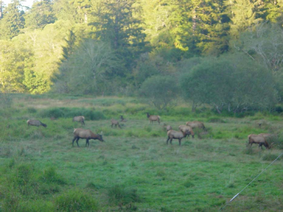
Random Wildlife Sighting: On the way into town, I passed this herd of elk. Not the first elk I'd seen, but these were kind enough to hang around long enough for me to get the camera, instead of just running off into the trees. By the way, you don't get any idea from this picture just how big these guys are. They make deer look small by comparison. It's probably a good thing these were pretty far off, because elk can be fairly aggressive.
The ride into Orick was a fairly easy one, but the first two hotels I came to were full, and the only other one I could see was permanently closed. The guy running the last hotel I checked was kind enough to inform me the next campsite and RV park (6 miles down the road) was huge and couldn't possibly be out of sites, so I felt pretty good at finding a spot. There was, however, nowhere to eat nearby, so while there I picked up my daily 2-liter of soda and also had some dinner. Then I set off, only to find another hotel just over the bridge and around the corner, after the point where I thought the town had ended. This hotel looked terrible, but rooms were only $30 plus tax, the cheapest I'd seen so far. No Internet, but then neither of the others had it either, so that's nothing special. I paid my money and moved in, glad to have found a comfortable spot for so little money. And yes, it turned out to be fairly nice inside, despite a few wall cracks and water stains here and there.
Speaking of that, let me ramble about that a bit more. Normally when I'm on the road I look for the cheapest possible hotel without regard to appearances or flashy features, asking only for a shower, bed and (if possible) wireless Internet. Other amenities, like continental breakfast or refrigerators or microwaves, don't really interest me, and I'd rather not pay for them if I can avoid it. The thing about cheap hotels is this: you can't tell from the outside what they're really like until you stay there. What they look like means nothing whatsoever. I've seen the ugliest ratholes you can imagine turn out to be diamonds in the rough, and really nice-looking places that fail on multiple levels. For example, the tiny little place I found in North Bend a few nights ago was cheap ($47) and looked bad from the outside, but the guy running the place was great, and the room had a full-size fridge and microwave packed in there. The one the following night ($62) cost more and looked better and cleaner, but had nothing special about it at all, nothing to warrant the extra price, and the wireless connection kept getting dropped so I couldn't do much online. Last night's room ($50), also very small, had a shower that didn't really work--the more I turned the dial towards "hot," the less water pressure there was. Maybe that was their way of conserving hot water? I don't know. Anyway, the point is, you can never tell. Tonight's is the cheapest yet and looks horrible, but the shower was great, and they had 200 channels of Dish Network instead of the usual 30 or so you get from hotel cable. So it's a crap shoot, and quite honestly, half the fun is finding out what you're going to get on any given night.
Anyway, more tomorrow. The road heads inland for most of the day, so the terrain could be challenging. We shall see.