This shaped up to be another insanely hot day, and in fact, when I left just before 10am, it was already almost 90. I'm pretty sure it hit 95 again and on the road, with the heat coming off the asphalt, it feels like a pressure cooker. In those occasional moments when I matched speeds with the wind (usually slowing down on the way uphill), it felt like the heat was literally pushing down on me...in other words, pretty horrible biking conditions, even with the tailwind helping out. If it weren't for that, or if I'd come to any kind of serious climbs, I probably would've stopped even sooner...or just waited until nightfall to finish off the last dozen miles (my "only if everything else goes wrong" strategy).
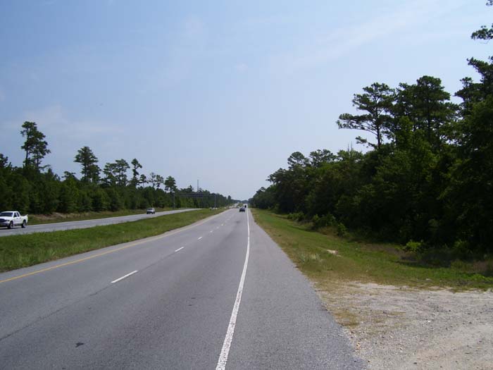
Also, since all I did was travel from one city to the next, with nothing really interesting in between, there aren't very many photos today. All in all, not much really happened, other than me torturing myself on the road. At least I had a shoulder today, as this is what I saw most of the time...a nice divided highway with a wide lane for me to weave around in while I made yet another grab for the water bottle.
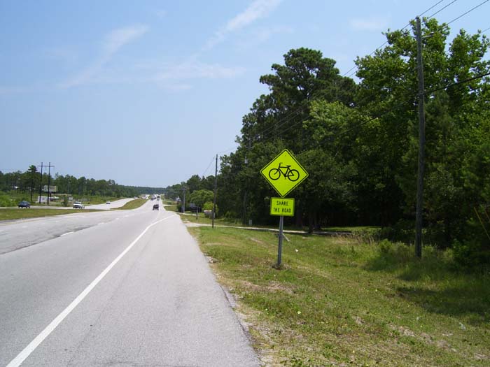
Ah, my favorite sign. Nobody listens, but I still like it. It reminds me it's okay for me to be out here. Oh, also notice the slope in the road. This was typical of the terrain...gradual ups and downs all the way. I met a retired biker (motorcyclist, that is) in a Hardee's at one break, and he told me if I kept going north, I'd run into mountains. I can't even imagine trying to cross a mountain range in these conditions. I doubt I could even do it, quite honestly. Only the relatively flat conditions and tailwinds are keeping me going at this point. (Oh, and I'm not going north, I'm going east to visit the Outer Banks.)
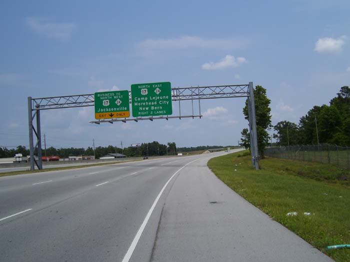
The one option I did have today was at about the halfway point, where I could either continue north to Jacksonville, or turn east and go around Camp Lejune to reach a town called Swansboro, where I might find some hotels. This would be about a 70-mile ride, but the disadvantage is, it would set me up for a required 75-80 mile ride the following day, racing the clock to catch the last Ocracoke Island ferry leaving at 6:30pm. I was still trying to decide about that when I got to my decision point and found this sign:
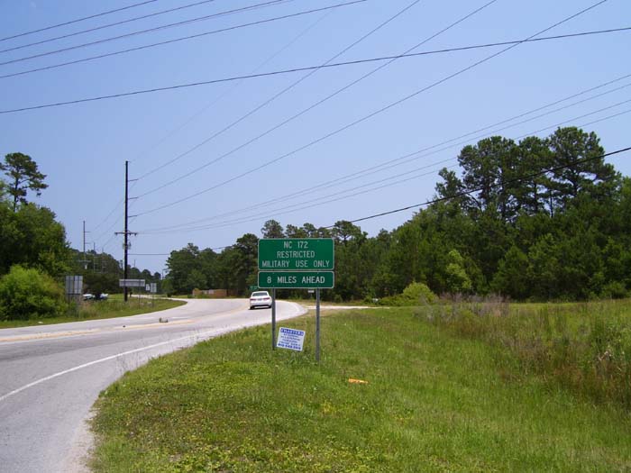
Okay, so, the road doesn't go around Camp Lejune, it goes through it, and since I have no military ID, I can't use it. So never mind about that. On to Jacksonville, it seems.
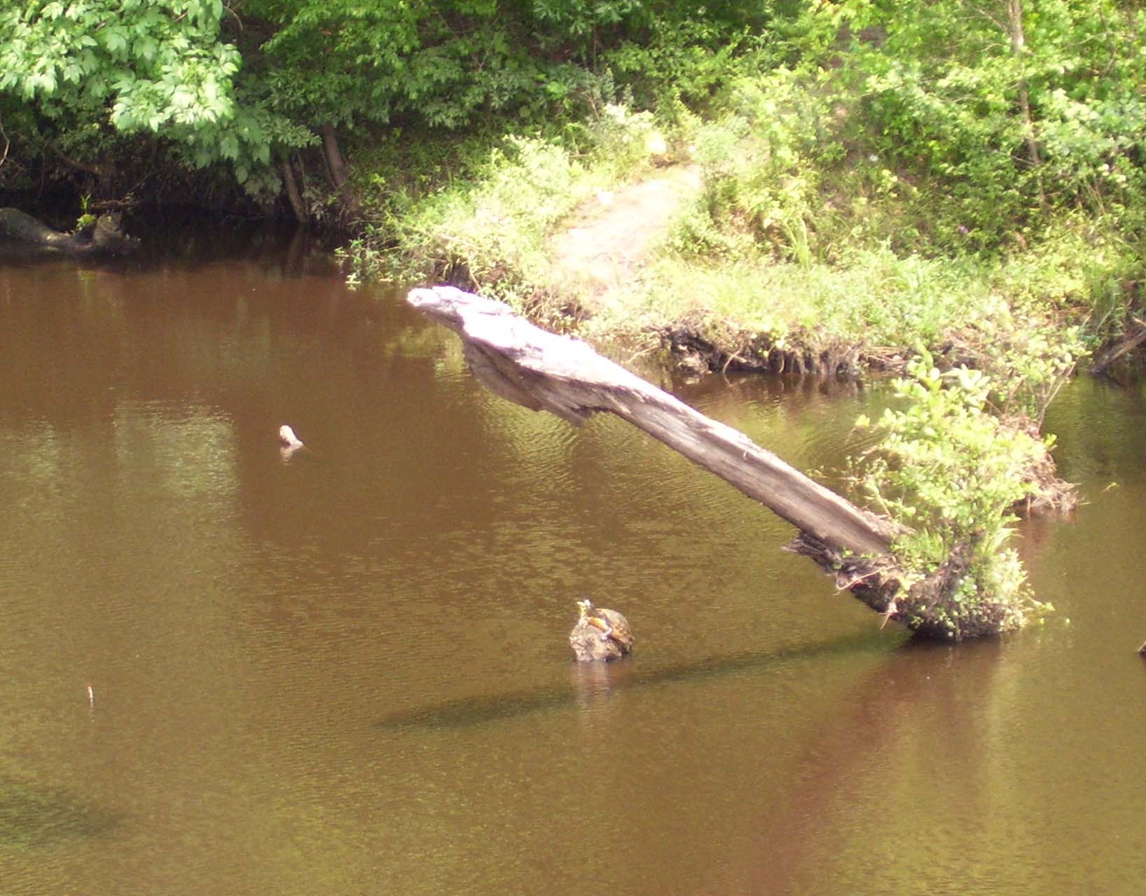
I did catch sight of a couple of military helicopters doing various military helicoptery things around the area, and while I took a photo of one, it seems it didn't come out, so I can't post it here. The only other item of note was this wildlife sighting as I crossed over a small creek. In addition to the...uhh...interesting formation there, the rock at the bottom has a turtle on it. Click the picture to zoom in closer and see what I mean. While I've caught sight of plenty of snakes and lizards on this trip, this is my first real look at a turtle (other that squashed roadkill ones, which don't count).
After that I continued on towards Jacksonville, staying on US-17, although it has a penchant for turning into highways near major towns and spawning off "business" loops that go straight through. See what I mean? The trick here is that I'm on the right hand side of this 3-lane highway, and the exit I need is the left-hand lane. I hate when they do that...I almost always wind up stopping at the actual split and having to wait forever to get a break in traffic so I can jump across.
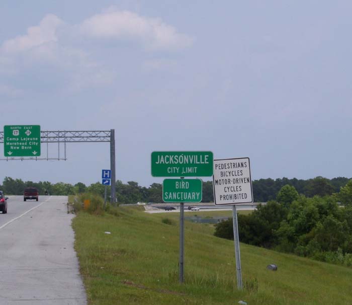
Fortunately, or unfortunately depending on how you look at it, I didn't have to worry about that today because a little further on I came to THE SIGN. Readers of my west coast tour will remember THE SIGN well...the one that says no bicycles allowed. And it's not talking about just US-17, it means that whole three-lane-wide piece of highway. So I had to turn around, loop back to the north, and go around to the next major road before linking back up with the US-17 business loop. This is part of the reason I actually wound up doing 60 miles today, because the whole trip really should've been more like the low 50s.
The business loop passed a couple of hotels I already knew were too expensive (thanks, Phil) so I kept on going, hoping to find something closer to the main gate of Camp Lejune, all the way on the other side of town. Sure enough, thee's a whole little community built up outside that gate, including plenty of restaurants, lodging, and everything else you might need...it looked like another whole town over there, just a few miles away from Jacksonville proper. So I wound up stopping for the day at around 4pm, which is fine because I spent the next several hours just collapsed on the bed trying to recover.
On the personal side, I was born in Goldsboro, NC, which is fairly close to here. My parents were stationed at Seymor-Johnson AFB, and my mother told me she remembered buying my first pair of shoes right here at the Camp Lejune PX. She remembered that because I wore size 5s (yes, I have big feet). Few outside my immediate family will care about this little detail, but it's sometimes amusing to see your life unexpectedly come full circle like that.
Oh, and on one final note, this is about my halfway point for this tour.